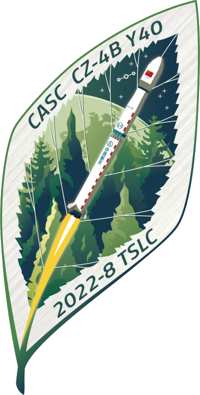
China Aerospace Science and Technology Corporation Terrestrial Ecosystem Carbon Inventory Satellite (TECIS) Long March 4B
About the Terrestrial Ecosystem Carbon Inventory Satellite (TECIS) Mission
- Type: Earth Science
- Orbit: Sun-Synchronous Orbit
Note: Launch vehicle and payload uncertain.
The Terrestrial Ecosystem Carbon Monitoring Satellite (TECIS) is intended to evaluate forest biomass, measure atmospheric aerosol content, and detect photosynthetic fluorescence. These measurements will contribute to efforts to combat global warming.
The satellite carries 4 instruments: Multi-Beam LIDAR, Directional Multi-Spectral Camera, Directional Polarization Camera, and Chlorophyll Fluorescence Hyper-Spectral Monitor (SIFIS)
The satellite will operate in a sun-synchronous orbit at a height of 506 km, at 10:30 AM local time in the descending mode, with a designed lifetime of 8 years.
Launch Pad & Location
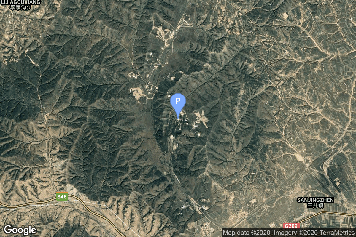
Launch Complex 9
Taiyuan Satellite Launch Center, People's Republic of China
The Launch Complex 9 launch pad has hosted 78 rocket launches, including 78 orbital launch attempts. The Taiyuan Satellite Launch Center, People's Republic of China launch site has been the location for 155 total rocket launches.
The Taiyuan Satellite Launch Center is a People's Republic of China space and defense launch facility. It is situated in Kelan County, Xinzhou, Shanxi Province and is the second of four launch sites having been founded in March 1966 and coming into full operation in 1968.
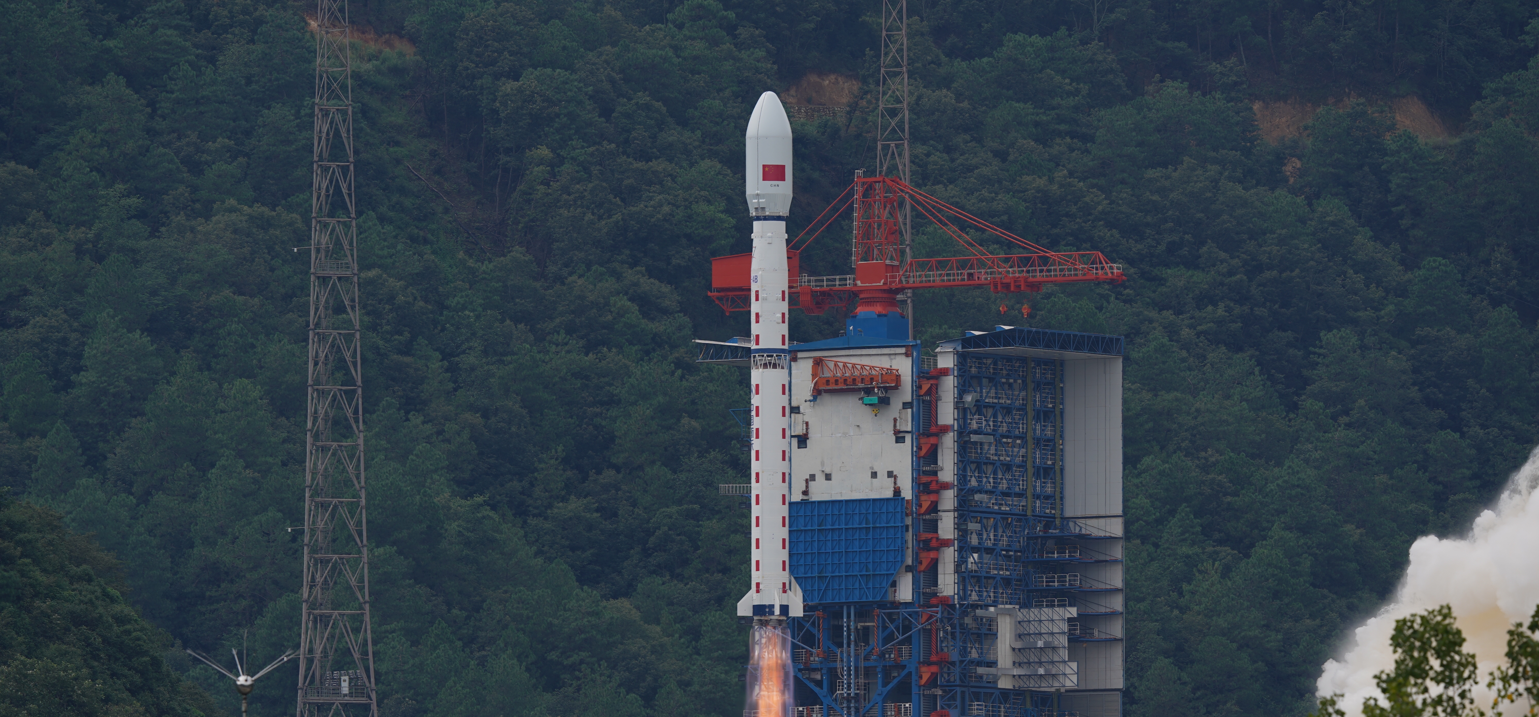
China Aerospace Science and Technology Corporation Long March 4B Rocket
The Long March 4B (Chinese: 长征四号乙火箭), also known as the Chang Zheng 4B, CZ-4B and LM-4B is a Chinese orbital carrier rocket. Launched from Launch Complex 1 at the Taiyuan Satellite Launch Center, it is a 3-stage rocket, used mostly to place satellites into low Earth and sun synchronous orbits.
Learn more about the China Aerospace Science and Technology Corporation Long March 4B Rocket
About China Aerospace Science and Technology Corporation
The China Aerospace Science and Technology Corporation (CASC) is the main contractor for the Chinese space program. It is state-owned and has a number of subordinate entities which design, develop and manufacture a range of spacecraft, launch vehicles, strategic and tactical missile systems, and ground equipment. It was officially established in July 1999 as part of a Chinese government reform drive, having previously been one part of the former China Aerospace Corporation. Various incarnations of the program date back to 1956.
Learn more about China Aerospace Science and Technology Corporation
Frequently Asked Questions
When was the China Aerospace Science and Technology Corporation Long March 4B Terrestrial Ecosystem Carbon Inventory Satellite (TECIS) launch scheduled?
The China Aerospace Science and Technology Corporation Long March 4B Terrestrial Ecosystem Carbon Inventory Satellite (TECIS) launch was scheduled for:
.
Where did the China Aerospace Science and Technology Corporation Long March 4B Terrestrial Ecosystem Carbon Inventory Satellite (TECIS) mission launch from?
The China Aerospace Science and Technology Corporation Long March 4B rocket launched from Launch Complex 9 at Taiyuan Satellite Launch Center, People's Republic of China. The Taiyuan Satellite Launch Center is a People's Republic of China space and defense launch facility. It is situated in Kelan County, Xinzhou, Shanxi Province and is the second of four launch sites having been founded in March 1966 and coming into full operation in 1968.
What rocket was used for the Terrestrial Ecosystem Carbon Inventory Satellite (TECIS) mission?
The Terrestrial Ecosystem Carbon Inventory Satellite (TECIS) mission launched aboard a China Aerospace Science and Technology Corporation Long March 4B rocket. The Long March 4B (Chinese: 长征四号乙火箭), also known as the Chang Zheng 4B, CZ-4B and LM-4B is a Chinese orbital carrier rocket. Launched from Launch Complex 1 at the Taiyuan Satellite Launch Center, it is a 3-stage rocket, used mostly to place satellites into low Earth and sun synchronous orbits. Detailed rocket specifications and performance data are available in the rocket details above.
What weather conditions could have delayed the China Aerospace Science and Technology Corporation Long March 4B Terrestrial Ecosystem Carbon Inventory Satellite (TECIS) launch?
The China Aerospace Science and Technology Corporation Long March 4B Terrestrial Ecosystem Carbon Inventory Satellite (TECIS) launch could have been delayed by various weather conditions including lightning within 10 nautical miles, high winds (especially upper-level winds), thick cloud layers, precipitation, and poor visibility. Weather must be favorable at the launch site, downrange landing zones, and abort landing sites.
How can I get updates if the China Aerospace Science and Technology Corporation Long March 4B Terrestrial Ecosystem Carbon Inventory Satellite (TECIS) launch was delayed?
This page was updated in real-time with the latest China Aerospace Science and Technology Corporation Long March 4B launch status, including any delays or scrubs for the Terrestrial Ecosystem Carbon Inventory Satellite (TECIS) mission. You can also check our space launch schedule for historical launch information. Our mobile app provides push notifications for instant alerts about launch status changes. Official China Aerospace Science and Technology Corporation live streams provided the most immediate range updates during the launch window.